Vietnam Maps
The following maps were produced by the U.S. Central Intelligence Agency, unless otherwise indicated. Country Maps
- Vietnam (Political) 2001 (208K) and pdf format (214K)
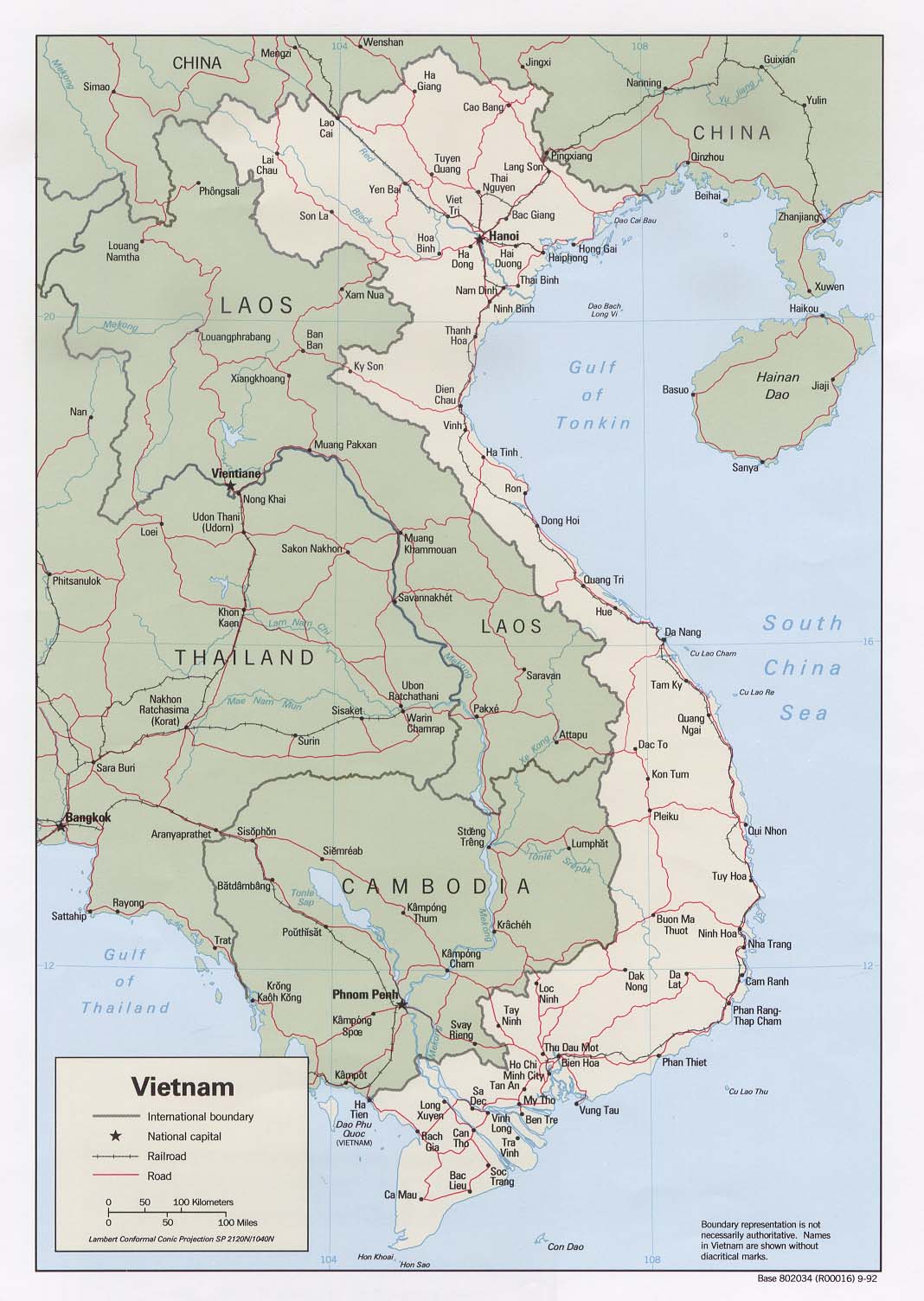
- Vietnam (Political) 1992 (189K)and pdf format (202K)
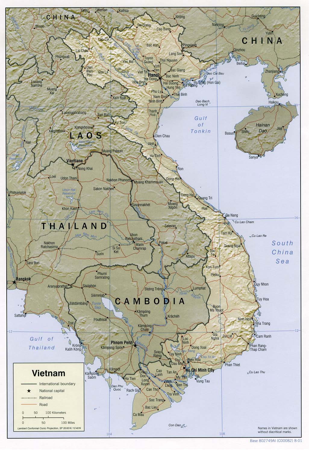
- Vietnam (Shaded Relief) 2001 (258K) and pdf format (261K)
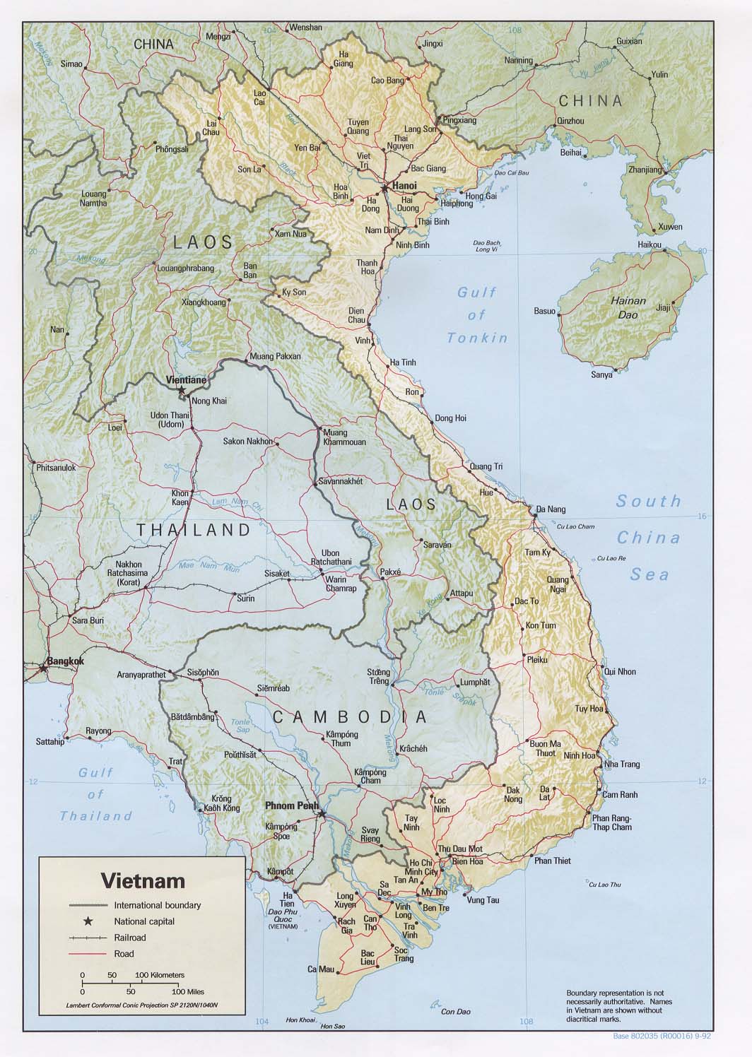
- Vietnam (Shaded Relief) 1992 (233K) nd pdf format (241K)
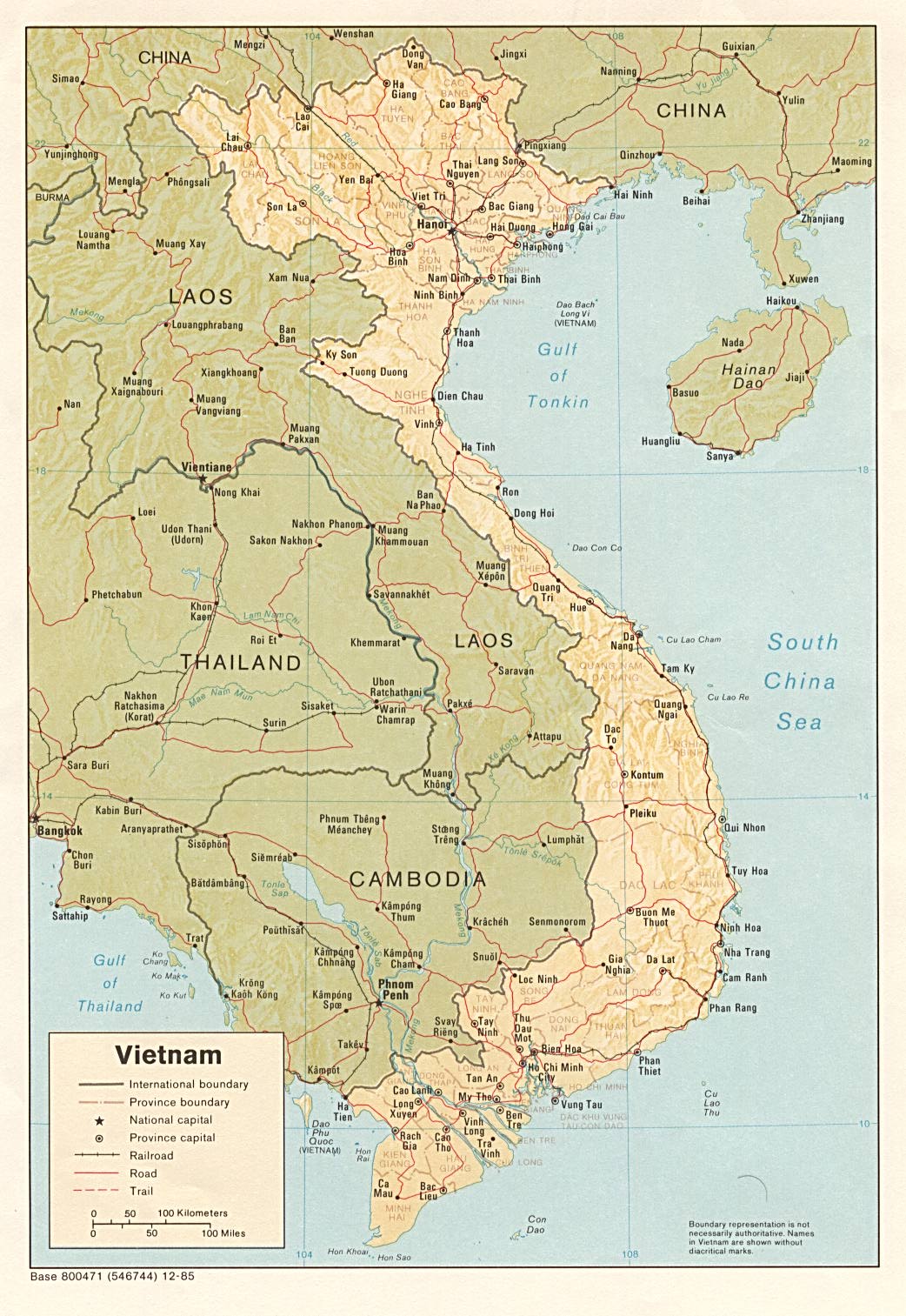
- Vietnam (Shaded Relief) 1985 (296K) pdf format (299K)
- Vietnam (Small Map) 2007 (21K)
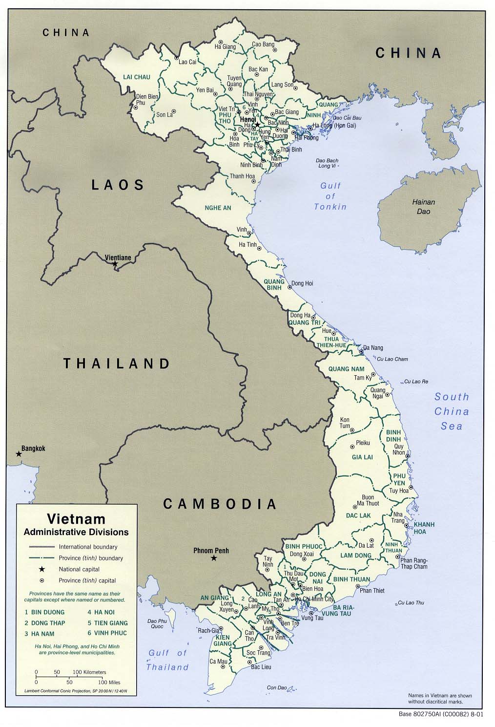
- Vietnam: Administrative Divisions 2001 (187K) nd pdf format (194K)
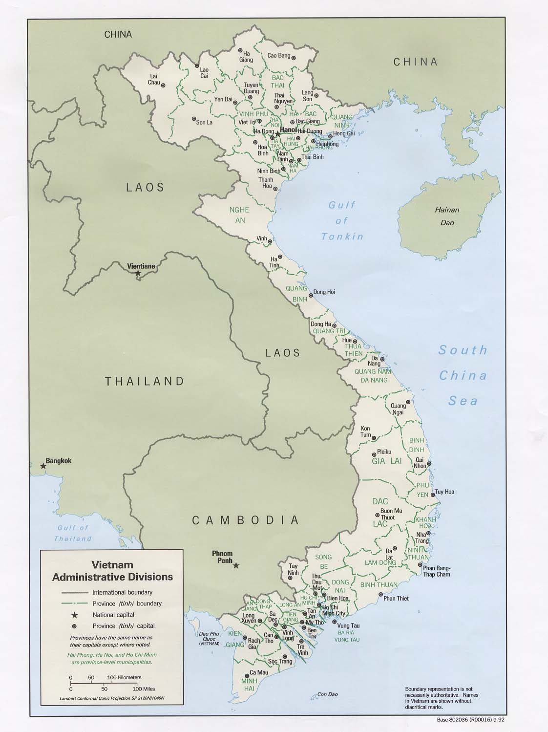
- Vietnam: Administrative Divisions 1992 (139K)nd pdf format (142K)
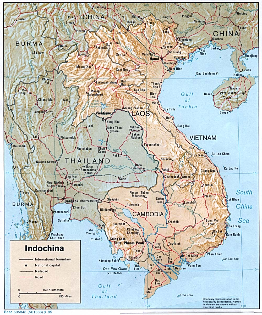
- Indochina (Shaded Relief) 1985 (342K)
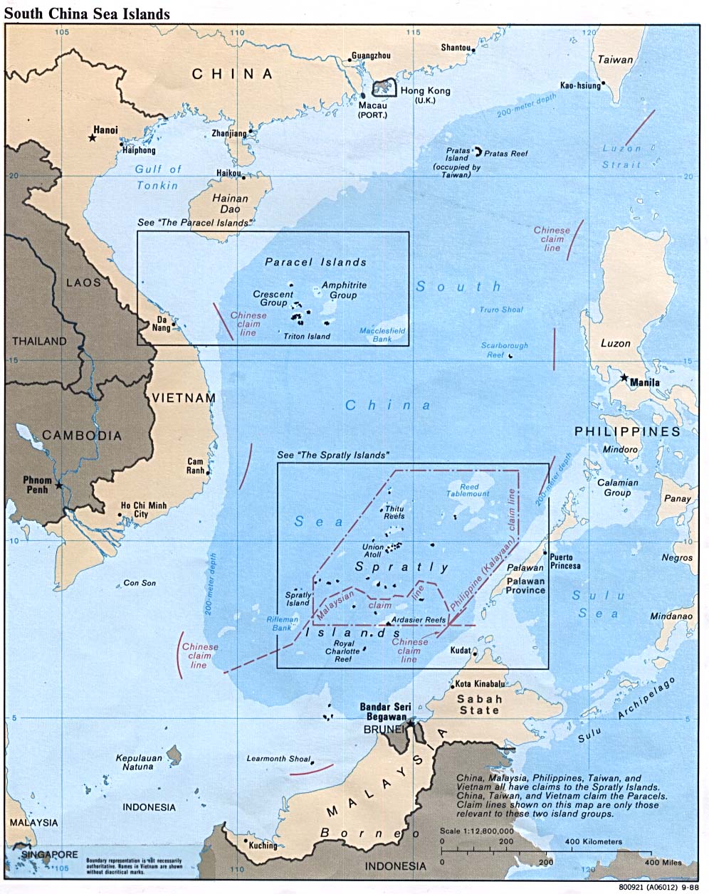
- South China Sea (Islands) 1988 (229K)
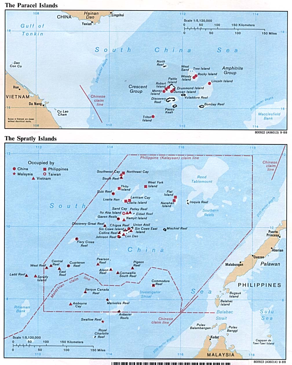
- Spratly and Paracel Islands 1988 (229K)
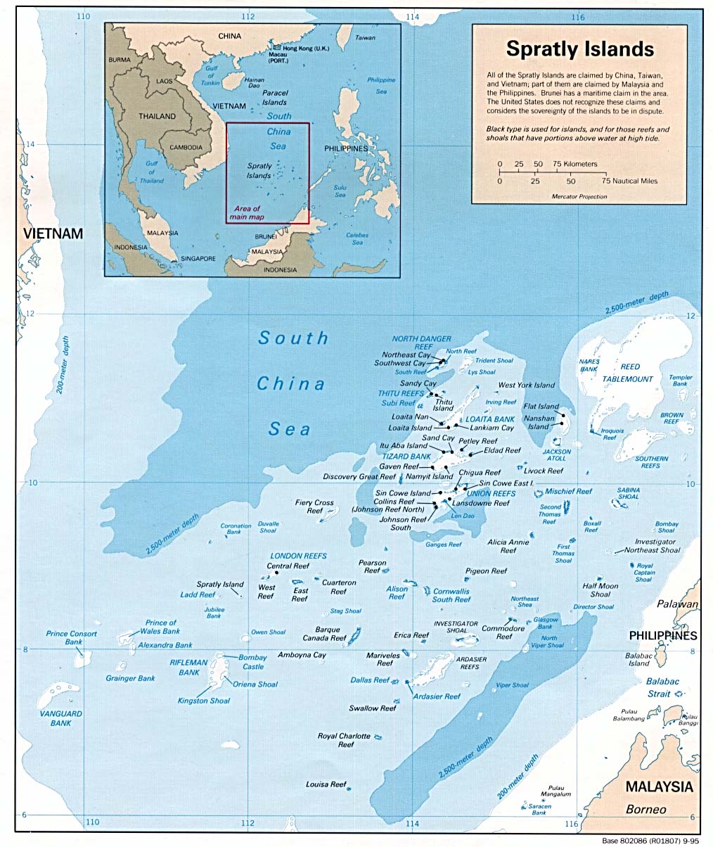
- Spratly Islands 1995 (218K)
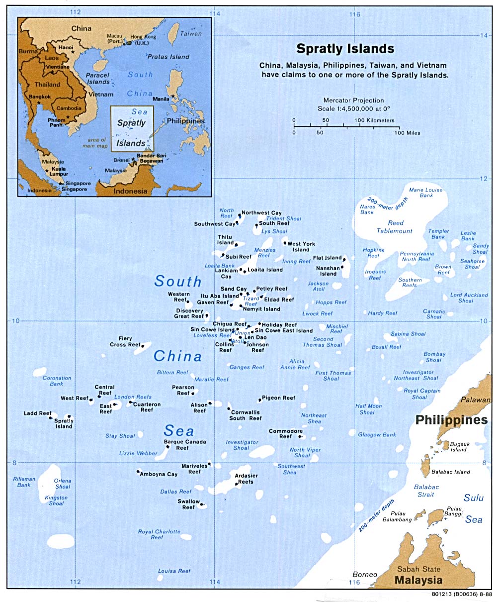
- Spratly Islands 1988 (223K)
- Spratly Islands (Small Map) 2007 (9K)
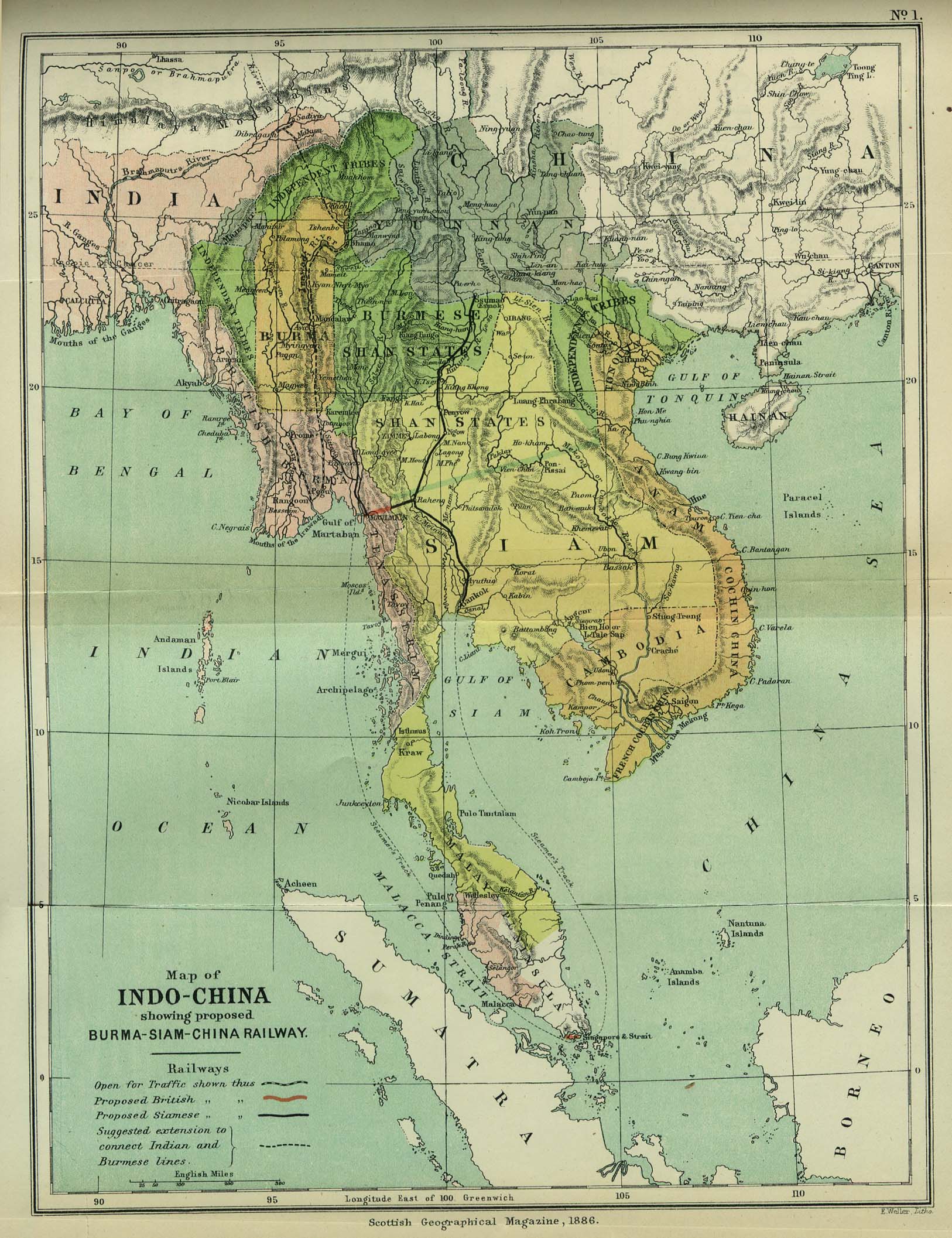
- Indo-China 1886 "Map of Indo-China showing proposed Burma-Siam-China Railway" from the Scottish Geographical Magazine. Published by the Scottish Geographical Society and edited by Hugh A. Webster and Arthur Silva White. Volume II, 1886. (533K)
- Indochina and Thailand, Series L506 (Topographic Maps) 1:250,000, U.S. Army Map Service, 1954-
- Indochina Atlas 1970
- Indochina Atlas 1970
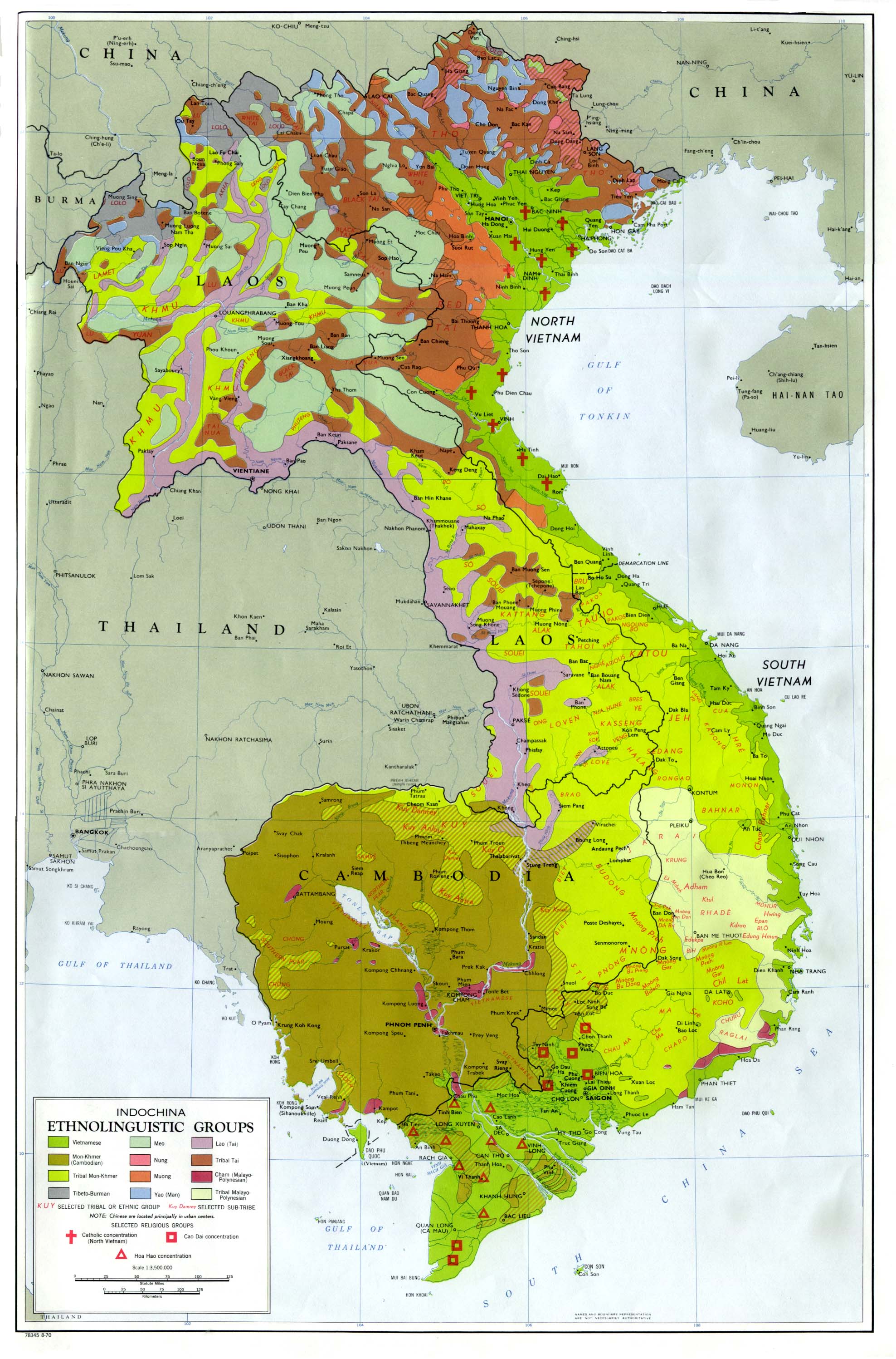
- Indochina Ethnolinguistic Groups From Indochina Atlas, 1970 (654K)
- Vietnam [South] - Economic Activity from Map No. 500874 1972 (140K)
- Vietnam [South] - Ethnic Groups from Map No. 500874 1972 (174K)
- Vietnam [South] - Land Utilization and Vegetation from Map No. 500874 1972 (174K)
- Vietnam [South] - Population from Map No. 500874 1972 (146K)
![Vietnam [South] - Economic Activity](http://www.lib.utexas.edu/maps/middle_east_and_asia/south_vietnam_econ_1972.jpg)
![Vietnam [South] - Ethnic Groups](http://www.lib.utexas.edu/maps/middle_east_and_asia/south_vietnam_ethnic_1972.jpg)
![Vietnam [South] - Land Utilization and Vegetation](http://www.lib.utexas.edu/maps/middle_east_and_asia/south_vietnam_land_1972.jpg)
![Vietnam [South] - Population](http://www.lib.utexas.edu/maps/middle_east_and_asia/south_vietnam_pop_1972.jpg)
Maps on Other Web Sites (http://www.lib.utexas.edu/maps/)